Length: 11.9 km | Duration: 6.20 h | Elevation gain: 1620m 377m
For the sporty ones.
This challenging mountain hike requires a good level of fitness and surefootedness. The highest point of the hike is almost 2,600 m above sea level, which means that alternatives must be considered in the event of bad weather (snow).
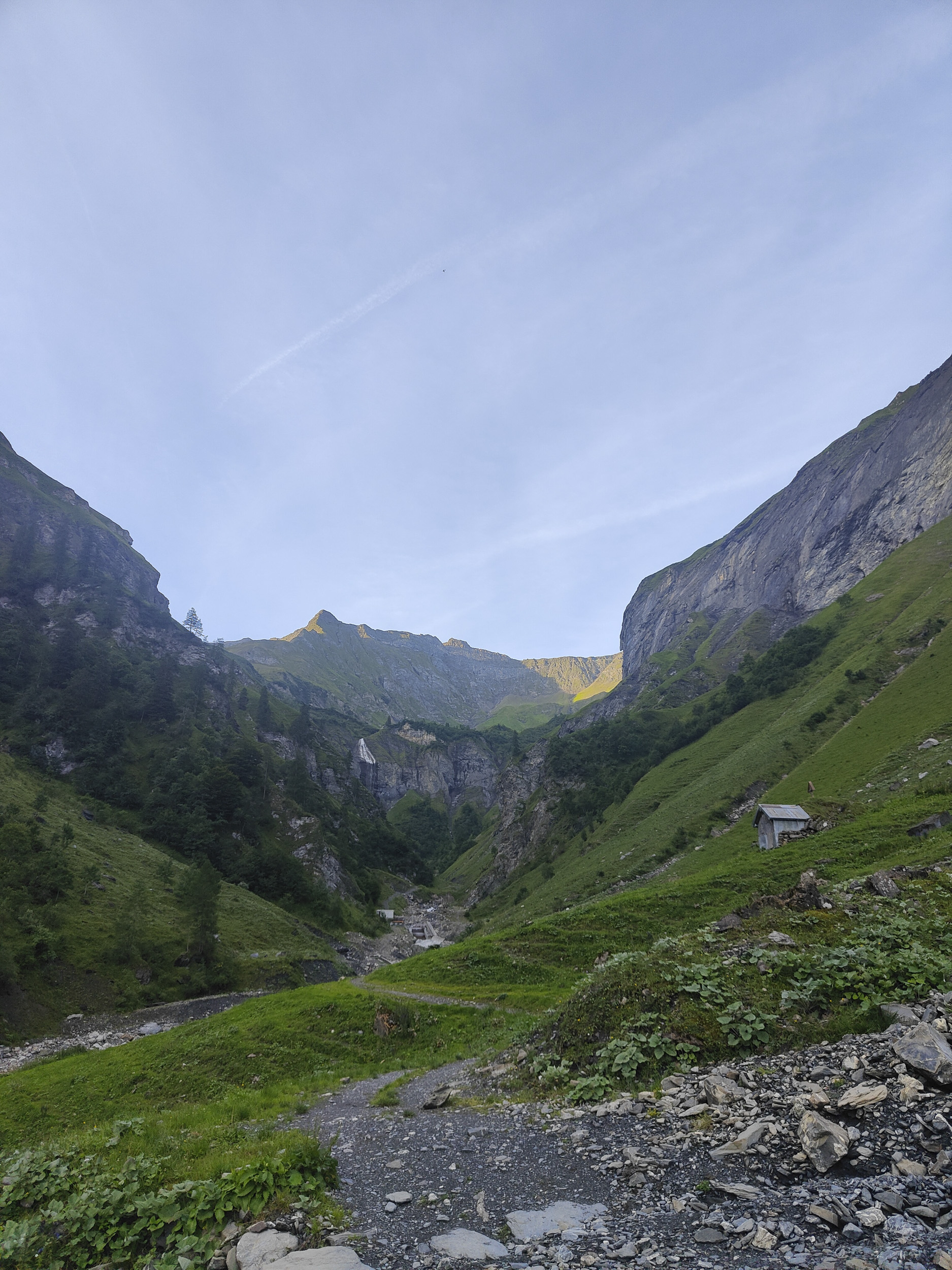
Cross the Gufelbach stream at the southern end of the village of Weisstannen (1003 m). After the bridge, the hike leads leisurely uphill along the stream, the first short section on a tarred road. At the end of the tarred road, the first steeper ascent begins through the forest and across meadows.
At Unterlavtina-Sässli, the valley opens up and you have your first view of the surrounding mountains.
The Rappenloch and the rocky slopes of the Marchstein and Hühnerspitz are at the top right. The first ibex were released in this area on May 8, 1911, after these magnificent animals had previously been wiped out throughout Switzerland.
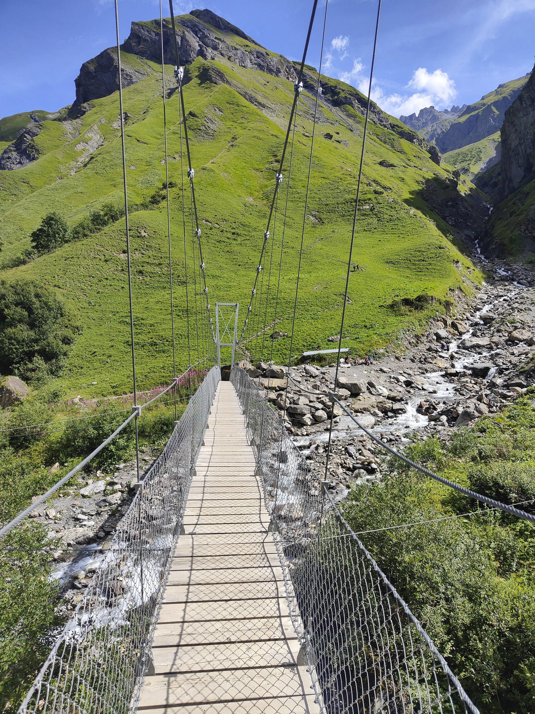
The path continues uphill in the direction of "Batöni/Pizolhütte". A footbridge leads over the stream to the other side of the valley, the path now leads directly along the Gufelbach stream.
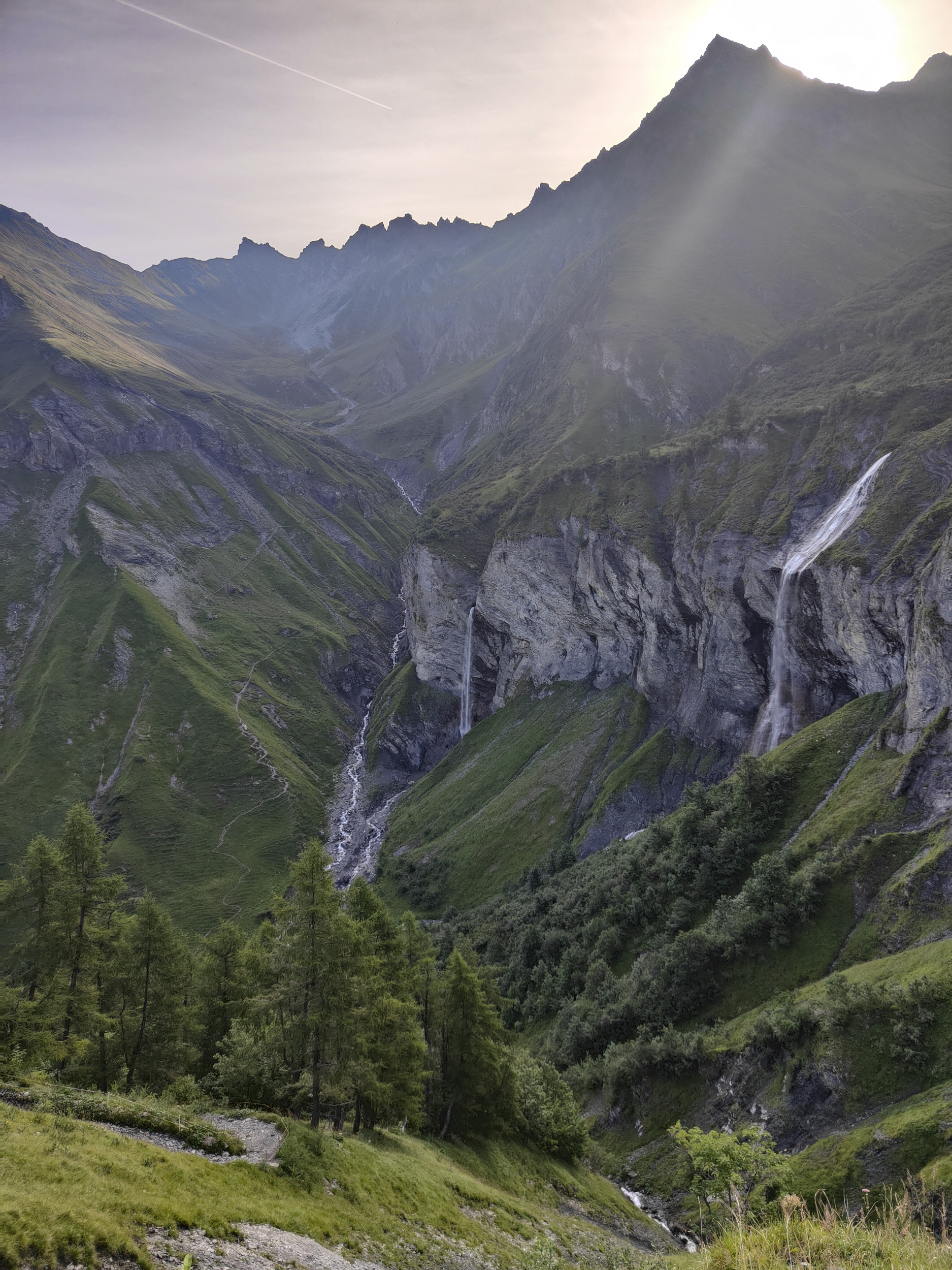
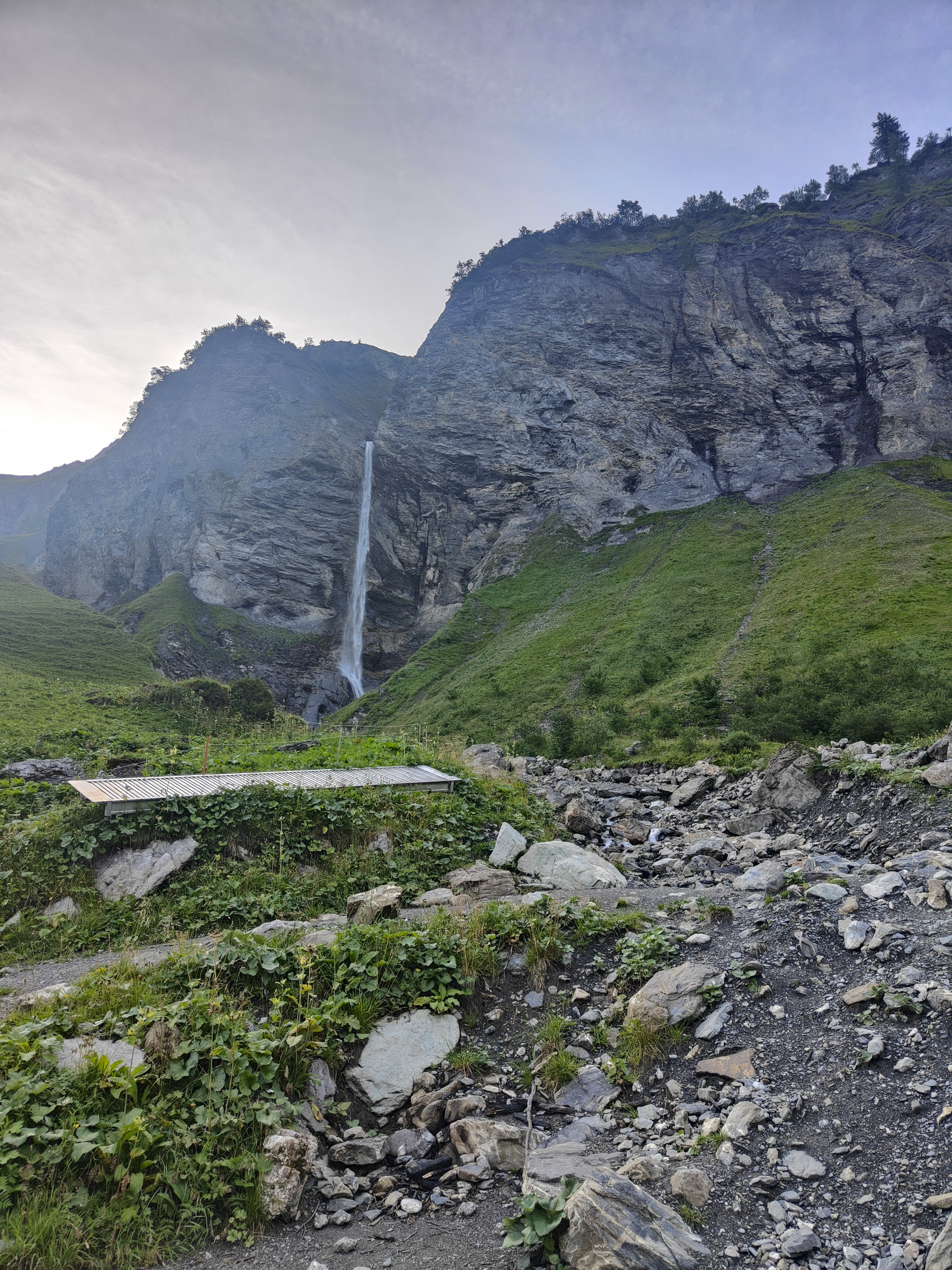
The impressive Batöni waterfalls can be seen from afar. These waterfalls come together from several sides in a basin, and when there is plenty of water in spring, this water castle is a very special place.
Here the path divides, to the right it would go over the Heidelpass to St. Martin in the Calfeisental valley. However, the path now leads steeply uphill to the left and is exposed in places.
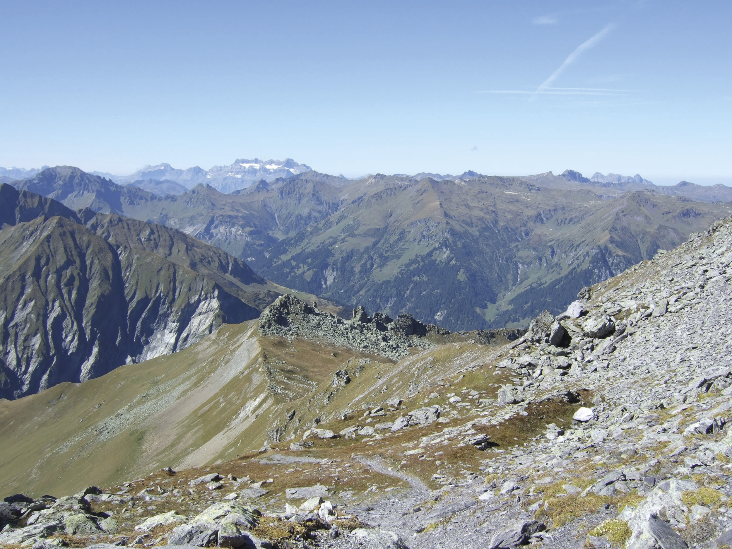
The view of the basin you have just left and, increasingly, of the surrounding mountains is magnificent. After Alp Stofel in Oberlavtina, you can see your destination, the Lavtina saddle at the left end of the mighty group of Lavtina Hörnern and Pizol.
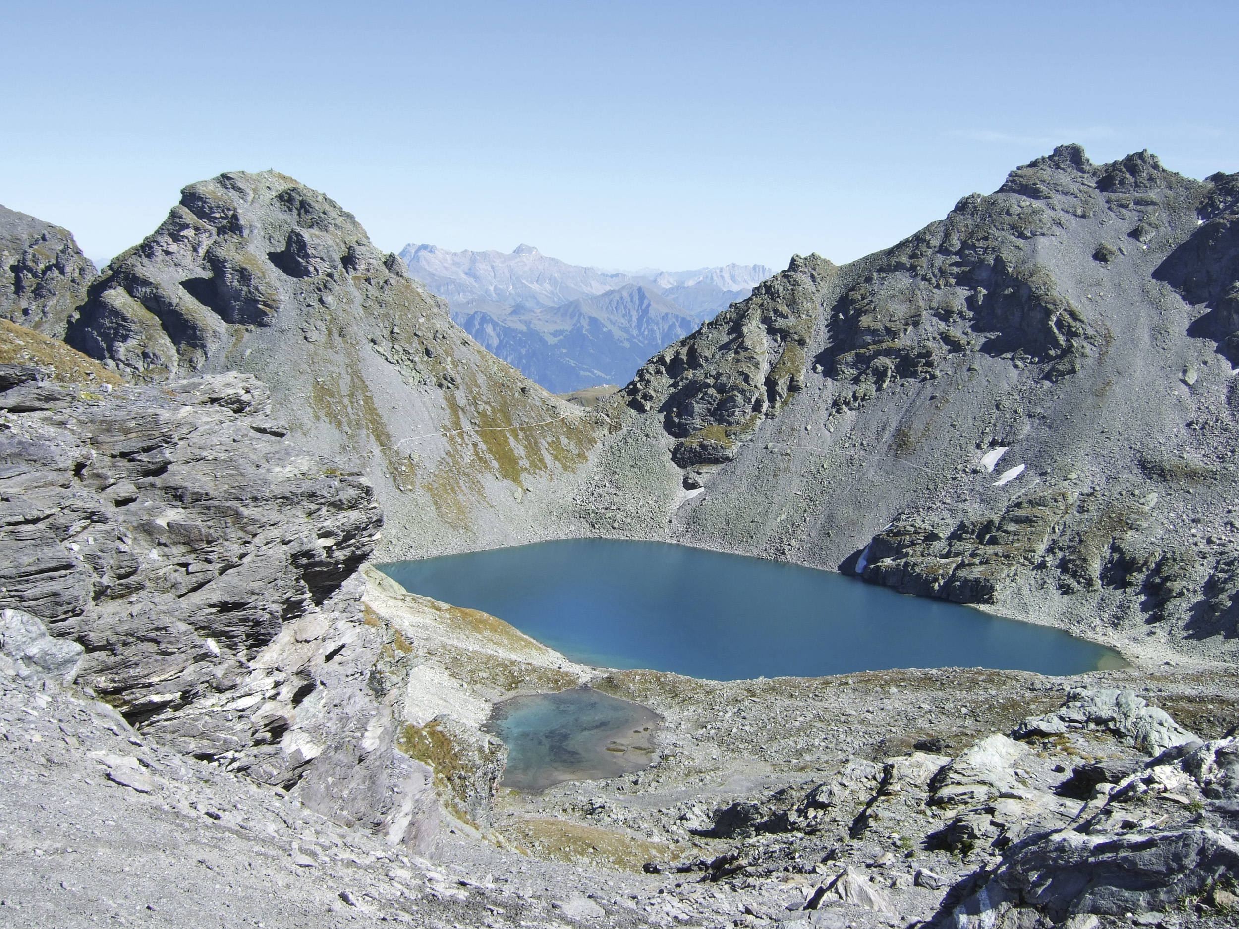
The path climbs ever more steeply, first across meadows and finally zig-zagging through a scree slope. On the Lavtina saddle, you have a wonderful view back to Batöni and the ascent, but also ahead to the Wildsee, which is fed by the Pizol glacier. The Hochwart with its summit cross is enthroned right next to the saddle. Now follows a steep descent through rock and scree towards "Wildsee", where the path leads above the lake through boulders to Wildseeluggen. The final descent leads over a scree slope to the Pizolhütte, on the first section of the famous 5-lake hike. Afterwards, a chair and gondola ride down into the valley to Wangs.
Route
Weisstannen - Unterlavtina-Sässli - Batöni - Alp Stofel - Lavtinasattel - Wildsee - Wildseeluggen - Pizolhütte
4-seater chairlifts Gaffia-Pizolhütte and Furt-Gaffia, 8-seater gondola lift Wangs-Furt
(1 hour)